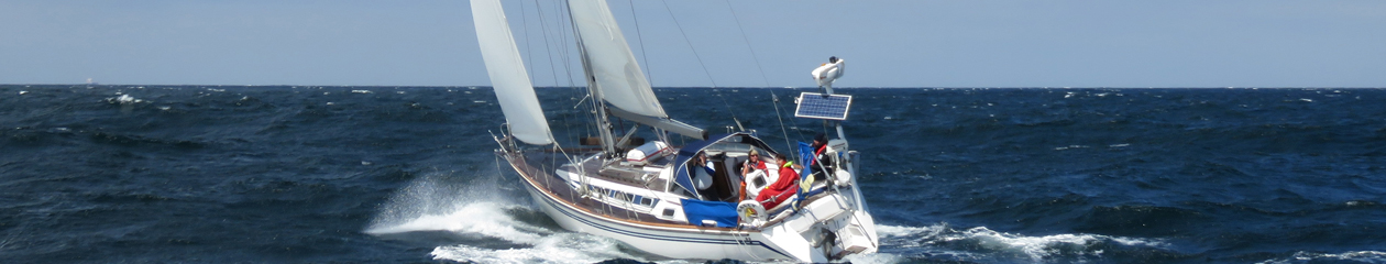
We have had water temperatures between 10 and 13 degrees all summer and often chilly winds. The long johns are automatically put on in the morning every day we go sailing. The caps are in the cockpit and are frequently used. The day we left Scalloway was no exception.
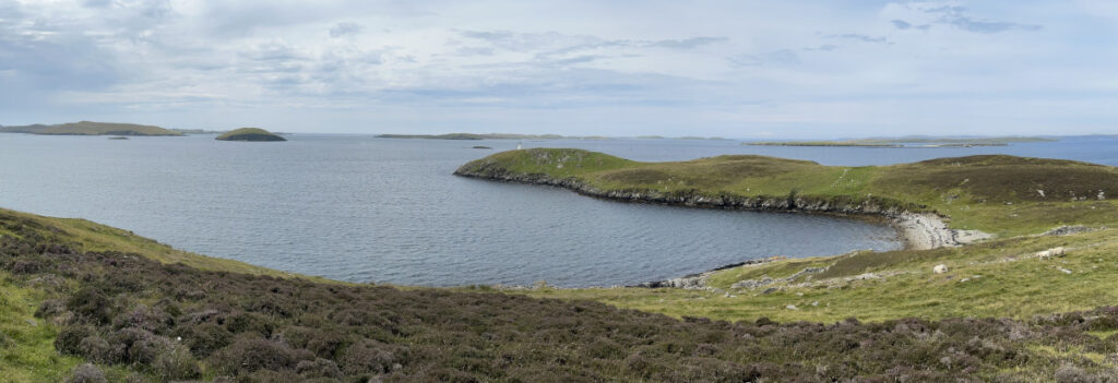
Another day, with confused seas took us to Fair Isle. The small island between Shetland and Orkneys. We had wind on the nose. It was strong enough, and westerly enough, to allow us to sail about half the way down.
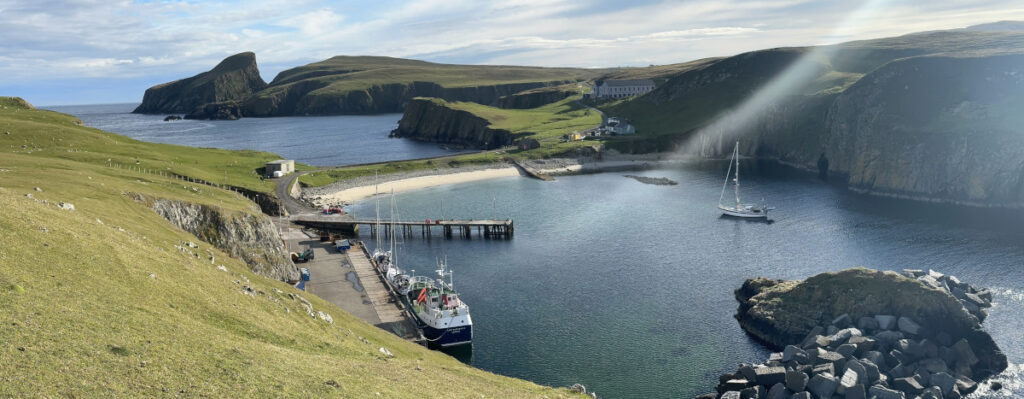
The harbour in Fair Isle is small and there is a dock (no pontoons) with room for two boats where you can tie up. A slight swell came into the harbour even if the evening was calm. The island has 12 permanent inhabitants but thousands of birds.
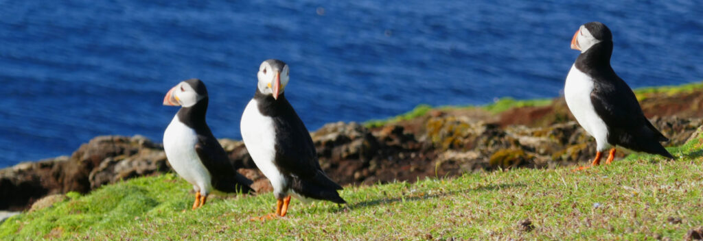
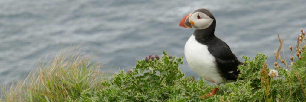
We walked up the hill east of the harbour after dinner and sat there watching the puffins come home for the night. The were surprisingly unafraid of us and appeared to be just as curious about us as we about them.
One can take the bus to Scalloway. It is a short ride across from Lerwick. Several other sailors we met suggested this. But no, we wanted to sail there. It was 44 nm and took us eight hours. There were occasions during the day when we understood why so many of our fellow sailors opt for the bus. But once here, we did not regret going.
It was a nice enough day when we left Lerwick, no rain or fog in the morning. We set sails just outside the harbour and sailed hard on the wind, with a few shot tacks, south along the coast. For a while, we sailed in company with an English boat motoring at the same speed.
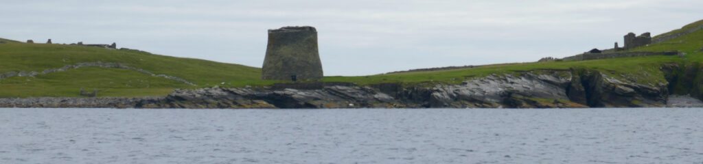
Our second tack was inshore to pass between the “mainland” and Mousa island. Partly because we expected the sea to be calmer there, but mostly to see the Mousa Broch. The 14 m high broch is believed to be almost intact and is still a prominent and impressive structure (well-marked on the chart). It turned out that not only the sea, but also the wind was lighter, and we saw the other boat well ahead of us as we left the sound.
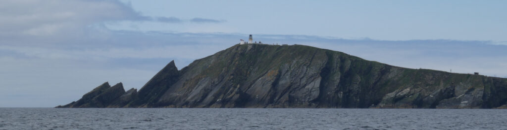
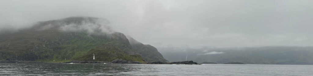
The wind died down when we approached the southern tip of the island, so we motored. Rounding at Sumburgh Head was the first time we understood why the bus might have been a good option. We had 2-3 knots tide going out way and meeting wind and swell. This creates an “interesting” sea state that could be downright dangerous in stronger winds.
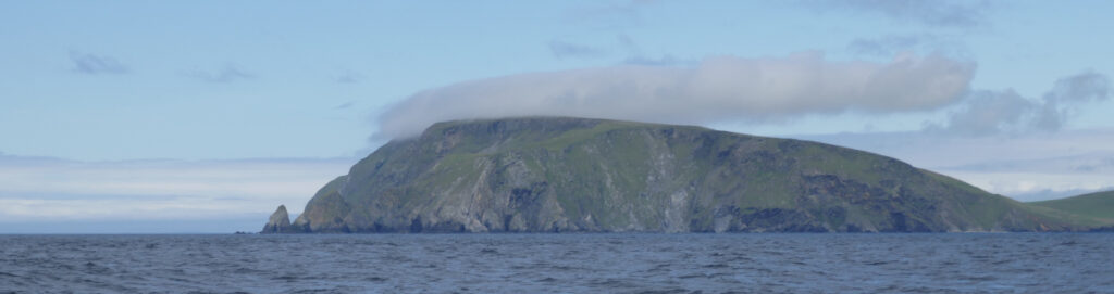
For us it was acceptable and as we were doing 7-8 knots, it did not last very long. We also had to pass Fitfull Head before we could turn north. By then the wind was back and we made good speed under sail. The head is a sheer cliff and the water outside it is quite shallow. The effect is a very confused sea. Another occasion to consider the buss but only for the half hour it took to pass the worst part.
We were surprised by the strong tide along the west coast. Good for us, as we had two knots helping us along on the nice sail up to Scalloway. And spirits were boasted by sunshine in the cockpit! The strong tides will guide our planning as we head south again, and it looks like we will have to make an early start.
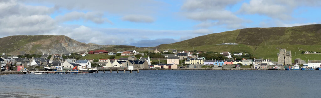
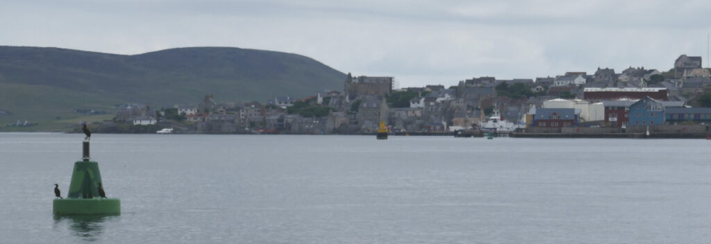
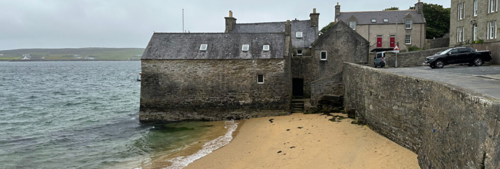
Scalloway is the old capital of Shetland. It was the centre during the Viking days and they had there court (Ting) in the fertile valley behind the town. The castle still stands and today the town has a little more than a thousand inhabitants. It played a central role in the so-called Shetland Buss during the war. A few hundred Norwegian fishermen played, with their boats, an important role in transporting material and people between Norway and GB.
Nice and quiet and we think we are the only non-Shetland boat here. The two other boats on the pontoon by the boat club are from Lerwick. We also have a friendly seal visiting by the dock from time to time. The advantage of being in a place with few visiting yachts is that you get a chance to talk to local people. They come to the boat or approach you in the bar. We have felt most welcome and have had many interesting conversations, even if their dialect is hard to understand sometimes.
We have stayed for three days now. The first day was a day for rest and laundry. The machines in the clubhouse had a meter to be fed with coins. There was a £2.5 credit when we started. To be on the safe side, we put in a one-pound coin. It turned out that our three runs with laundry and two full dryers consumed les than the pound we added. Luckily, there were not so many others using the machined so we could do more laundry yesterday and today on some of the remaining credit.
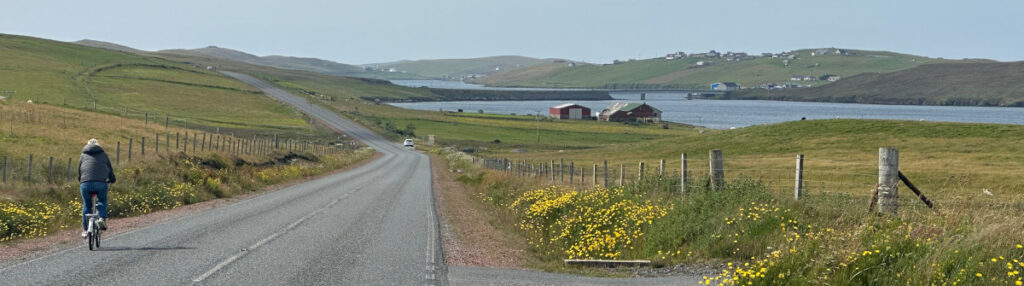
Yesterday we cycled around the bay and a bit down West Burra. Picnic on a nice beach and then a tour by Hamnawoe, a very protected bay filled with rubble from decades of activities and thus unsuitable for anchoring. It has a marina but only for local boats. It looked like cycling country with hills below 25 m, but there were many of them and we got quite exhausted, having climbed a total of over 200 m, before we were back onboard.
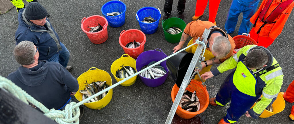
The boating club, where we stay, had an angling competition in the evening. They also opened the bar for the weekend, beer at reasonable prize and close to the boat. Lots of people and lots of mackerel.
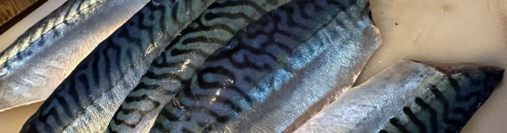
Some of the fish got thrown back in the water after everyone that wanted to, was able to take some. We got a nice dinner today on fried mackerel.
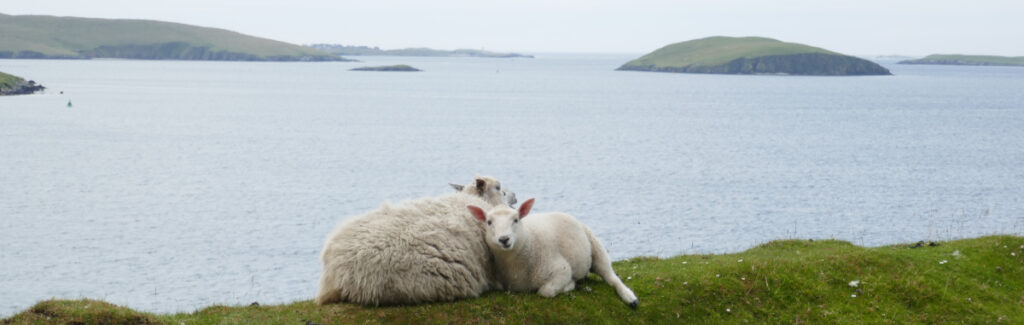
Today, we walked to the lighthouse and said hello to sheep and ponies grazing on the hillsides. We also had a last cappuccino at cafe in town.
We have spent some days in Lerwick now and the plan was to sail today to a nice anchorage just a few miles down the coast. However, the forecast this morning was for fog and later rain. Not the best weather to be at anchor so we will stay another day.
We left Maloy and Norway early Thursday. The weather was not inspiring with low clouds mist and rain and no wind, but we know that it would improve later in the day. What we did not know was that the forecasted moderate swell would be so irregular, short and generally confused giving us a rather unpleasant journey for the first 24 hours. We had an explanation for the sea state from a Begen sailor. The Norwegian current runs up the coast and meats the swell from the north making the swell short and irregular.
The skies lifted and a moderate northerly breeze picked up. It was enough to give some air in the sails, but the swell rocked most of it out, so we kept on motoring. We could not turn of the motor until five hours out when the wind was steady above 13 knots giving enough pressure to keep the sails full all the time.
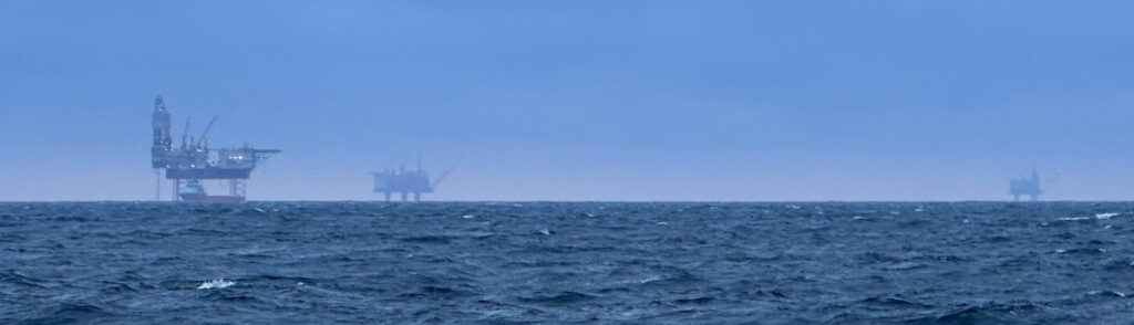
The wind increased further, and we soon found ourselves with a reefed mainsail doing seven knots on an open reach in winds at 20 knots (10 m/s) and some. This wind lasted until early the following morning, and we were making good headway towards Shetland. When we headed up a little between the oil riggs, we even had to take a reef in the genoa to make the sailing a little less uncomfortable.
The wind became moderate in the early morning and the swell more even already after the oil fields. We found ourselves motoring again over a calm sea after breakfast and arrived in Lerwick half past two (15:30 Norwegiantime) after 215 nm and 34 hours.
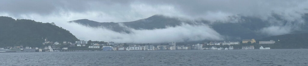
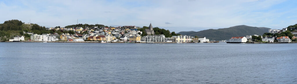
Lerwick is a nice little town and a refreshing change from Norway. Don’t misunderstand us, we loved Norway but after nearly three months and retracing our outward journey the last weeks, we needed something different. We had out first pint of beer after clearing customs (by internet in advance and confirmation by phone) and fish and ships for dinner, and a long night sleep..
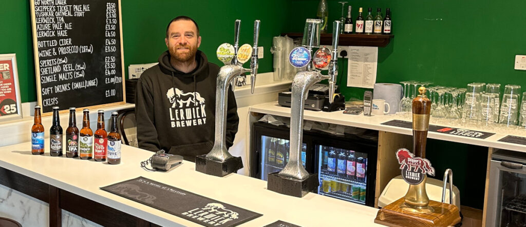
The nice girls in the tourist office, whom we have visited several times for information, recommended several trips around the island by the local busses. We had planned to rent a car, but this proved unnecessary. The first trip was up the hill to near the local brewery. For £1.2, we got within 10 minutes from the brewery.
Lerwick brewery is open for visitor, guided tours or just tasting. We selected to taste all their different beers and were lucky to be the only visitors at the time. We got to talk with the brewer, a guy from California who had married a local girl, and he gave us lots of information on the products but also places to see and sail to.
On his advice, we walked instead of taking the bus back. There was nothing wrong with the directions, but we took a higher route from the hill we had to pass as we taught it would take us to where we wanted but with better views. That was not to be, and we found ourselves walking further and further from our rout. We walked a considerable detour and, in the end, jumped some fences to sneak through a private garden to get back in the right direction.
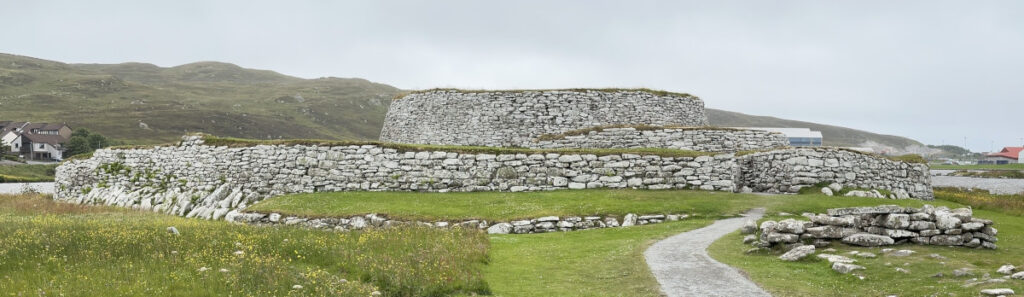
We finally arrived at Clickimin Broch, a stone structure probably built between 2 400 and 2 100 B.C. The broches are only found in Northen Scotland and on the islands. The structures were much higher in it’s time. Scholars debate whether they were prestigious houses or local strongholds.
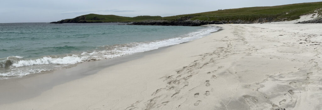
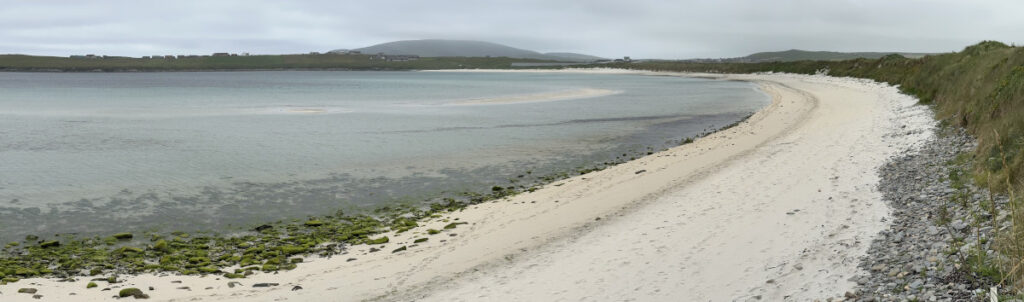
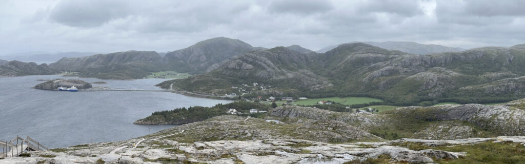
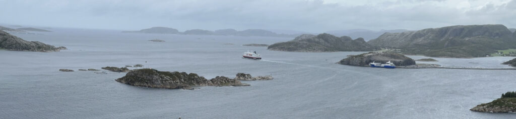
We took the buss south the following day. A one hour ride took us to the southernmost part of Shetland. Here, there is a large, white beach. It looks inviting but the water is less than 12 degrees., so no swimming for us.
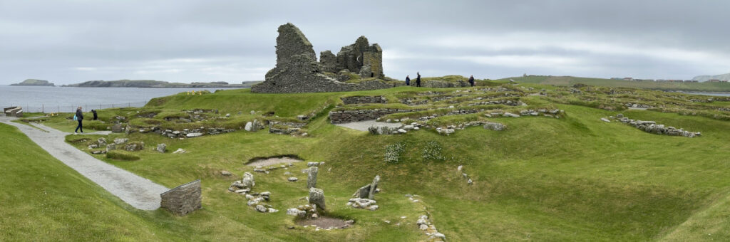
The hotel served lunch and after lunch we saw Jarlshof. This site is very interesting. Here one will find historic remains from different times side by side. The earlies dates back 4 500 years. Here were bronze age houses of different ages, a broach, several Viking houses, a 13:th century farm and, the tallest ruin, a 16:th century laird’s house.
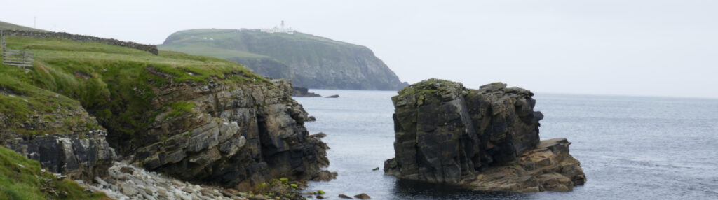
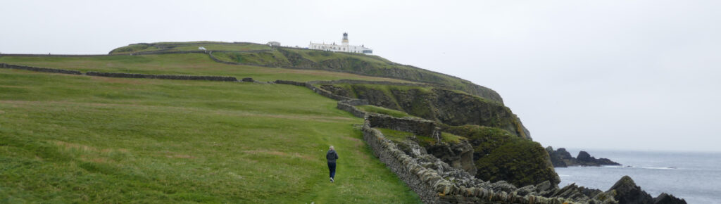
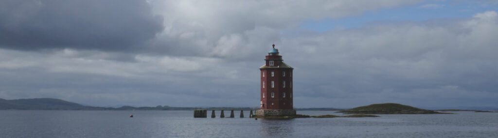
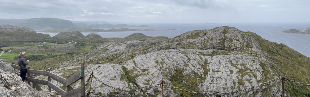
A 2 km costal path leads from Jarlshof to the lighthouse on Sumburgh Head.
The head has a large colony of birds, and we were finally able to see the puffins close by. We have seen them flying and fishing but never close enough to the boat to get a good look.
The light house had a nice cafe with good coffee and splendid views to revive us before walking back to the bus stop. We were early so we had time for a quick one in the hotel bar before heading home.
Yesterday was a day for provisioning and cleaning, and beer at the boating club. Today, we have fixed some small things on the boat and rested. The Indian restaurant Safron served good food in large porions. Now we hope the forecast will come through for tomorrow.
The forecast was for northerlies, but we saw very little of them. We sailed for 20 minutes downwind in a good breeze just by the corner. And then again after another hour of motoring, reaching for 15 minutes by one of the larger bays in a breeze that died down behind the next point.
We arrived in Maloy (Måløy) in the afternoon and fuelled up on the way in. Rain in the afternoon but, we managed to provision between the showers.
We motored in calm waters and light winds on the nose the short distance (10 nm) from Borgaroya to Sandshamn on Sandsoya (Sandsøya). The marina in Sandshamn has been modified and now features very good pontoons in a square. We went inside and moored below the buildings with just enough water under the keel.
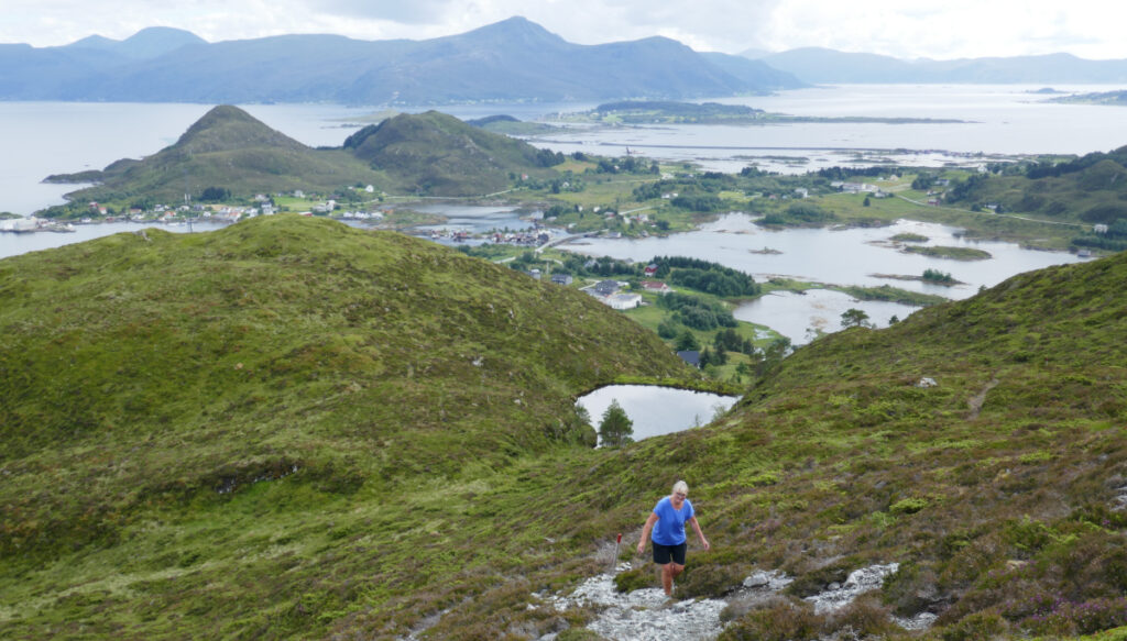
Sandsoya offers several nice walks with spectacular views. We chose the one to Grontua (Grøntua), 250 m above us. We walked counterclockwise and that was a lucky shot. Going down the path we came up (without problems) would have been more challenging as it was much steeper in places compared to the rather easy one we came down on.
There were several places to stop to admire the views and from the top, they were spectacular.
Coming down more gentle slopes to a hardtop road for the last descent.
Today has been a day of looking after the boat. Light winds and rain showers as we wait for the promised northerlies on Wednesday. We have cleaned the forward cabin and dried out mattresses and all the stuff we store under the bunk. We have also defrosted the refrigerator, there was more ice than food in the small freezer compartment and fixed a number of smaller things.
There was no wind as we left Oye yesterday morning after a slow breakfast. The wind picket up dead on the nose again as we entered the main fjord. OK we taught, we will turn 80 degrees to the SW as we leave the fjord and should have some nice sailing then.
That was not to be. Instead, it started to rain as the wind was coming “around the bend” and stayed on the nose until we reached the sound to Alesund, that opened to NW. Finaly, we were able to sail – for an hour until the next mountains blocked the wind.
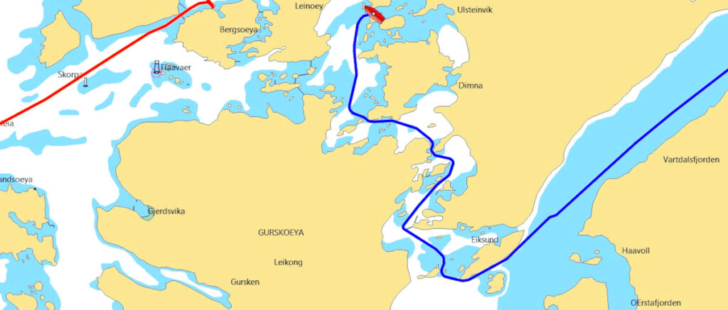
We took an inland rout SW and decided to go between the islands of Gurksoya and Hareidlandet.
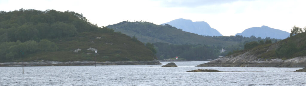
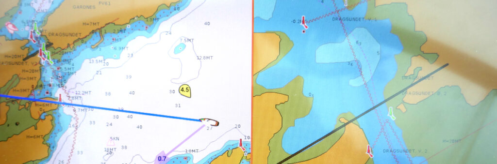
There is a narrow and winding channel starting SW of Eika. It crosses what used to be the world’s deepest road tunnel, 260 m below the water.
Looking at the chart, we would not have chosen this route but, we had had a nice conversation with a sailor born and raised in the area at Oye and he assured us that it would not be a problem.
Despite this, our speed through Dragsundet was very slow and cautious.
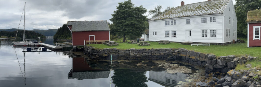
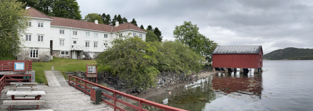
The entire 8 nm of fairway is clearly marked and no less than 5 m deep and with 20 m clearances under bridge and cable at Dragsundet, so we did OK. From this nice channel we continued a little bit further north to Borgaroya (Borgarøya). This island has been home to trading posts since 1616 when a merchant from Bergen started the business. The grandfather of our friend from Oye had been running it in his days.
Now the place is owned by the municipality of Ulstien and the local sailing club has been instrumental in arranging a nice pontoon with electricity and water. A quiet dock in beautiful surroundings.
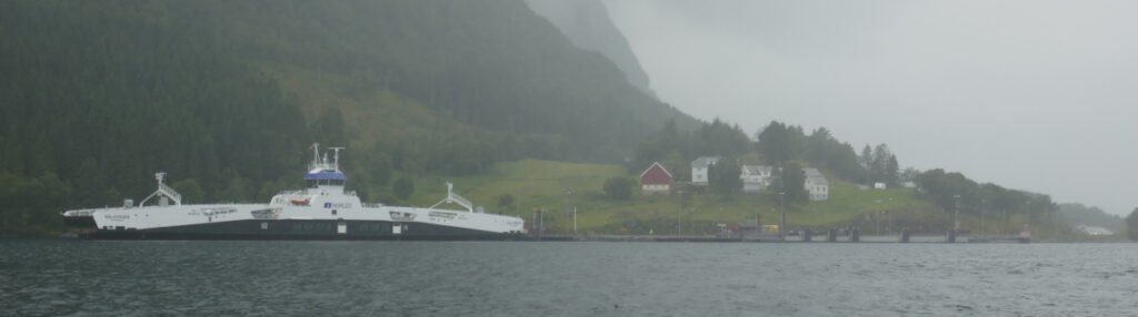
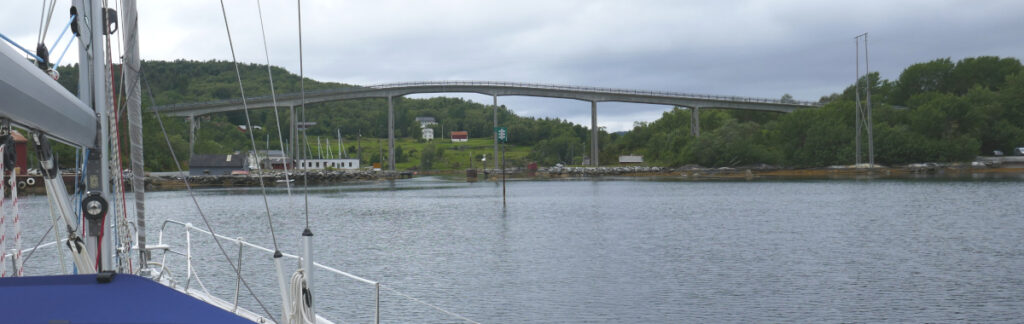
This mornng was exiting. The bridge across the sound at Midsund had a clearance of 18 meters which is lower than our mast. This led to a rather deep search for how to interpretate. Norwegian pilot (Den Norske Los Bind 1) informed us that bridges and cables were measured from highest astronomical tide.
Next problem, how to find the tide and highest astronomical tide? The Norwegian Meteorologisk institutt has a WEB page “” (and an app but the app does not have this data) where one can find a forecast for “Sea and coast” for a lot of locations. At the bottom is a table for “Predicted tides”. Below the table is a link to more detailed information where you may find everything you need if you scroll down.
Having done this exercise, we concluded that we could safely pass under the bridge with our 19,5 m mast (including antenna) on the rising tide until eight a clock in the morning. Now, the second problem was the forecasted rain the same morning as we do not like to sail in the rain. We woke up around seven and there was no rain, so we prepared to leave the dock and almost managed to do so before the rain started.
With our cockpit tent up, we cautiously pasted the bridge successfully in heavy rain. The rain continued almost until lunchtime as we motor against choppy waves and rather strong wind dead on the nose. We turned southwards after Alesund (Ålesund) and had a nice reach towards the fjord for an hour or so.
Passing a rainy Alesund
Now, one characteristic of Norwegian fjords is the high mountains that surround them. They turned our nice downwind sail to a flat calm rather suddenly and the motor was back in service again. We prefer sailing but, a small comfort whilst motoring is the nice heating we get for free as we have a water based central heating system with eight radiators heated by the engine cooling water.
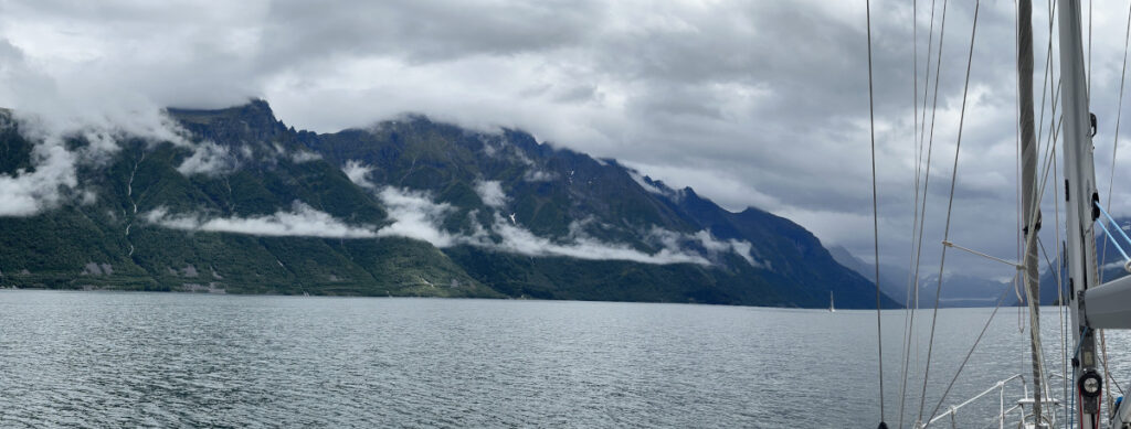
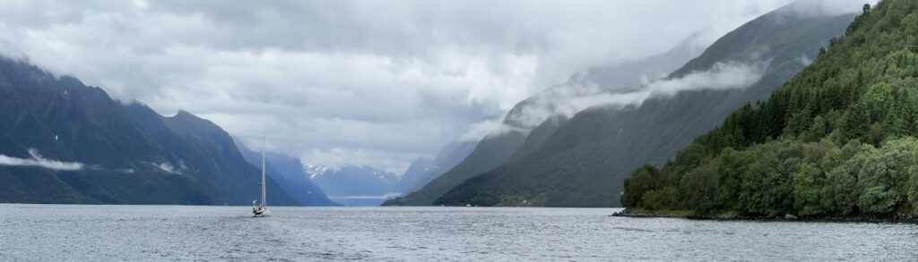
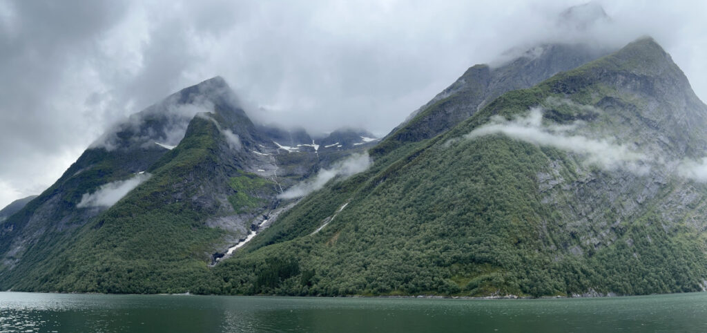
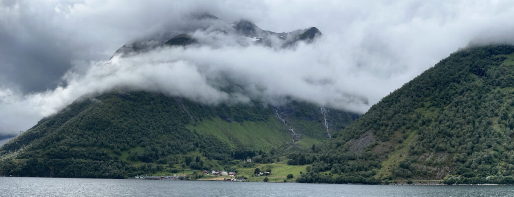
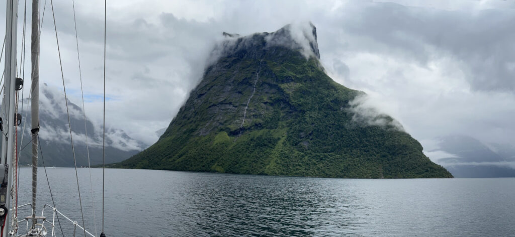
We wanted to visit Hjorundfjorden (Hjörundfjorden). It is by many regarded as the most beautiful fjord in Norway even if it’s next door neighbour to NE, Geiranger, is more famous.
Hjorundfjorden is rather short and “compact” and this makes it interesting to navigate. The surrounding mountains are majestic, and we were lucky enough to have the clouds lift and even let some sun in as we went inside.
There are several villages and harbours along the fjord.
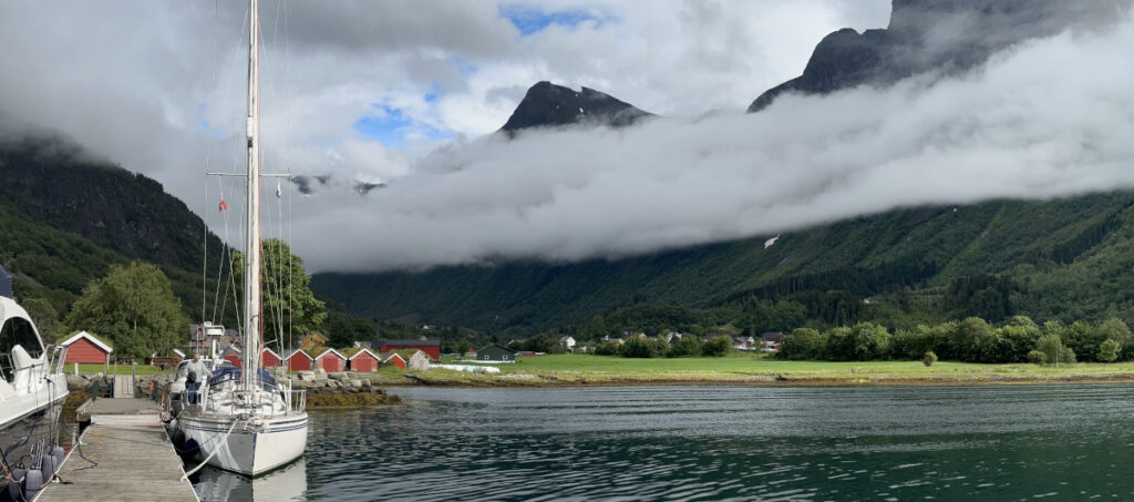
Oye (Øye) lies at the bottom of a branch to the east in a beautiful small valley. We moored to the ponton for the night.
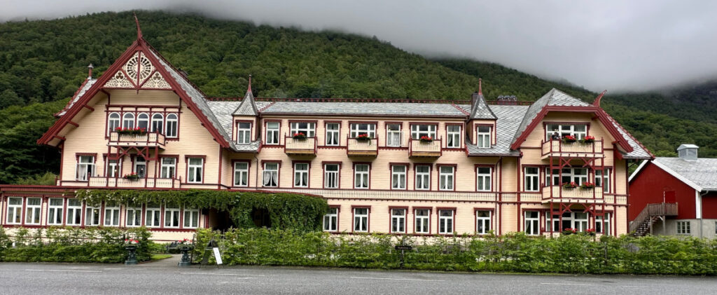
Oye is home to a very famous hotel, built in wood, from the turn of the last century. They operate the dock and friends that visited earlier in the season were offered a combo of docking fee and breakfast at a reasonable price. Now the hotel was full and could not accommodate us for breakfast.
We had a nice evening stroll in the valley and along the fjord. Strawberries and raspberries were ripe and provided a small desert.
Another rainy day allows us some rest and time for administration and laundry today. Tomorrow looks promising and we hope to be able to continue sailing. There are some interesting fjords just south of Alesund that we would like to explore.
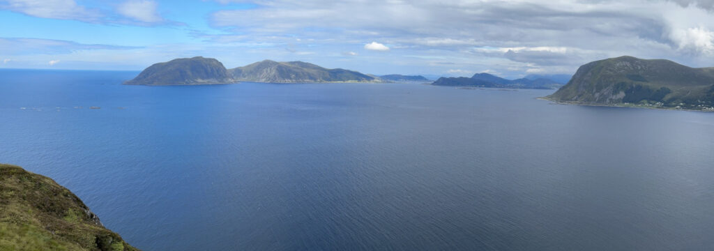
We left Mageroya and was met by a westerly in the fairway outside. It was perfect for sailing, and we started tacking upwind.
Slow going against wind and a week tide for a couple of hours before the wind died down. Out faithful engine was put back in service all the way to Kristiansund. It was sunnier then on the last visit.
We heard from a Norwegian boat thar one should have fish and chips in “Fishan”. The instructions were clear, as always, when we got them but, it took us three trips along the docks and roads before we found it (good exercise). It was a small shop that had a 60’ies feel and the fish was excellent (and the ships a bit underdone to our taste).
We left quite early and were able to sail downwind for a few hours before the wind became to week in the swell of “Hustaviken”. Back to motoring past impressive breakers.
We met one of the Swedish boats, Lotte, on our way and chatted on the VHF for quite some time. It had, unfortunately, not been possible to arrange to meet in a harbour, maybe next time.
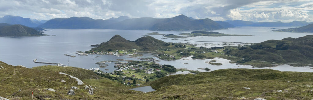
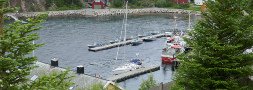
We arrived in Midsund in the afternoon and were lucky to get the best spot in the marina from a boat just leaving. The marina is very nice and there are several groceries and other shops nearby. The islands offer a lot of well chartered hikes.
It was sunny and warm. Maybe a little to warm for a hike up the stair. This time we only did 150 meters above sea level where we stopped for a beer (non-alcoholic) and to admire the view.
We left Kuringenvagen before breakfast and motored southwest in the archipelago. Past Kjeungskjær Lighthouse lighthouse once again.
Sone after, the fairway turned south and we had a moderate westerly for about 30 minutes that allowed us to sail until a wooded island blocked it out. Back to motoring and as we turn SW again, increasing wind heading us.
We motor all the way to Mageroya (Magerøa). This is a recreation island owned by the Norwegian state. They have done a nice job of keeping the old trading post buildings in good condition. And a lot of effort have recently been devoted to restoring the open agricultural landscape of old days.
Mageroya is known to have been inhabited since before Viking days. It has been important for the trading along the coast for centuries.
Visitors are welcome and there are now two pontoons, all with finger pontoons. One finds many paths and activities for all ages on the island.
We were lucky to be able to have the kids onboard during three sunny and warm summer days. They had barely left before the clouds returned. We motored south from Rorvik and were able to sail for a while before the wind turned against us and the clouds thickened.
We found ourselves banging into an increasing wind and a shoppy sea after another hour. The cockpit cover was up as the rain had started to fall. Temperature had dropped from well over 20 to 15 and the long johns and sweaters were back in service to keep us warm. Why fight the elements? we taught and headed inshore.
It was a detour of a few nautical miles but we probably did not lose any time as the going was faster between the island. The sea had settled, and the wind and rain subsided, when we headed out to sea again for the southern part of “Folla”, the stretch of open water on the fairway south.
We stopped at Bessaker, an old trading post, for the night and to weather the wind and rain forecasted for the following day. Bessaket turned out to be well protected from the SW winds but it was blowing strong, gusting 40 kn (20 m/s) and the wind-waves in the sound outside “rounded the corner” and caused some swell at the pontoon.
The rain was over in late afternoon allowing a walk up the 951 wooden steps to “Vettan” 145 meters above the sea. This has been a site for lookouts and signalling for more than a thousand years. Hakon I the Good (Håkon I den gode) established a system with beacons to be lit to warn for dangers along this coast around year 950. Bessaker was one of them and was in use for many centuries. It was also used as a lookout for the Norwegian army in WW I and for the Germans during WW II.
The view from the top was magnificent. The wind was so strong that it was difficult to walk or stand upright so, we walked back to the lee of the harbour.
We had sun for 3-4 hours yesterday morning and used this to motor to Kuringenvagen, Stokksund. We have stayed here today, another rainy day, and hope to be able to continue SW tomorrow.
I denna blog skriver vi lite nu och då om båten och våra seglatser. Kontakt: sally@bikan.se +46708220250